New
England Soil Profiles
Ice Wedge Casts
Link to the NEIGC Paper on IWC (Stone/Ashley)
|
|
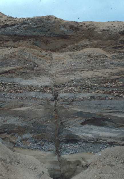
Photos by Jim Turenne, photo location - Hain Brothers gravel
pit in Windham, Ct.
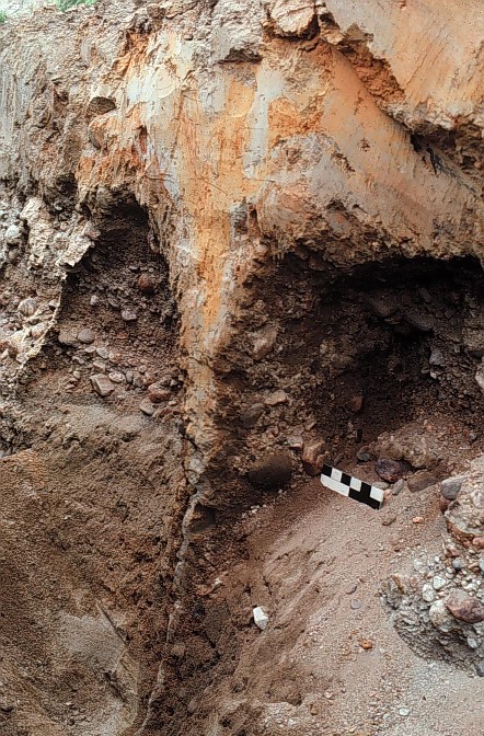 |
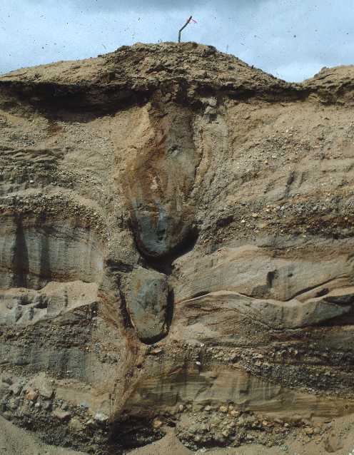
Ice Wedge Cast
located in a gravel pit in North Kingston, RI Photo by Jon Boothroyd, URI Department of Geosciences Ice wedge casts are evidence of permafrost conditions which geologists
interpret occurred in the the Northeast, these features formed
immediately after the landscape deglaciated. For more information on Ice Wedge Casts refer to: Stone, J.R. and Ashley, G.M., 1992, Ice-wedge casts, pingo scars, and the drainage of Glacial Lake Hitchcock: In, Robinson, P. and Brady, J.B., eds., Guidebook for Field Trips in the Connecticut Valley Region of Massachusetts and Adjacent States, v. 2 (84th Annual meeting of the New England Intercollegiate Geological Conference), Amherst Massachusetts, University of Massachusetts, Geology Department, Contribution 66, p. 305-331. Info from Fish and Wildlife Service: http://arctic.fws.gov/permcycl.htm
|