Click for Photo
Click for Photo
| Slope | Elevation | Aspect | MAAT | MSAT | MWAT | MAP | Frost-Free Days | Drainage Class | Slope Length | Upslope Length |
|---|---|---|---|---|---|---|---|---|---|---|
| 1 percent | 16.8 meters | 90° | 9.4° C | 20.4° C | -1.9° C | 1225 millimeters | 201 days | somewhat excessively |
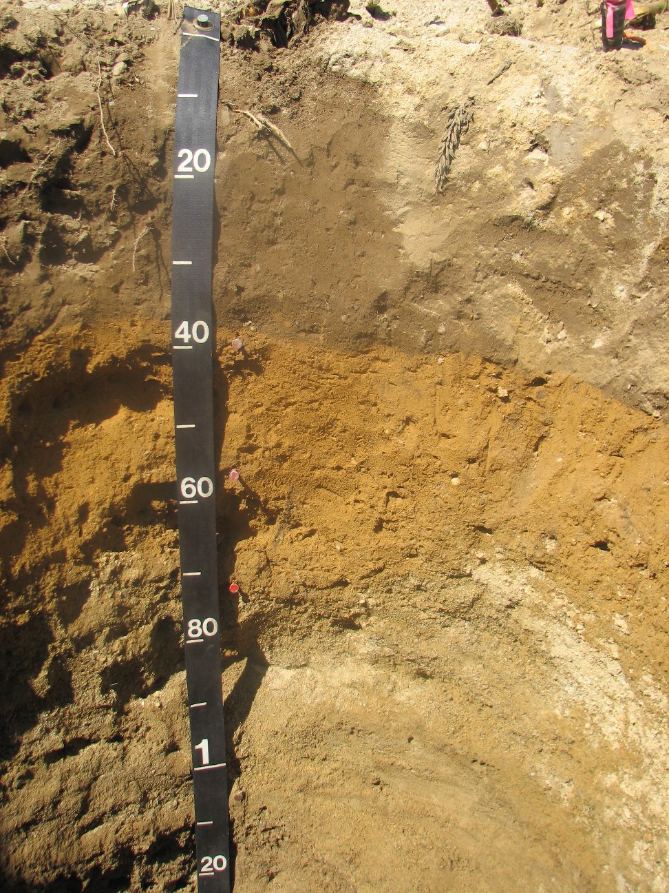
Ap --- 0 to 37 centimeters; dark brown (10YR 3/3) moist, interior, sandy loam; pale brown (10YR 6/3) dry, interior; weak medium subangular blocky structure; friable, nonsticky, nonplastic; moderate permeability; few very fine irregular low continuity pores; 4 percent subrounded 2 to 76 millimeters mixed rock fragments; slightly acid, pH 6.4, Bromthymol blue; A hint of a plowpan in lower part of Ap horizon. Pocket penetrometer readings 2.75, 3.75, 4.25; original spring used. Dead corn roots observed in horizon.; abrupt smooth boundary. Bw1 --- 37 to 54 centimeters; dark yellowish brown (10YR 4/6) moist, interior, sandy loam; weak medium subangular blocky structure; friable, nonsticky, nonplastic; moderate permeability; few fine tubular high continuity and few very fine irregular low continuity pores; 8 percent subrounded 2 to 76 millimeters mixed rock fragments; slightly acid, pH 6.2, Chlorophenol red; Slight increase in Db at Ap top of horizon contact. Pocket penetrometer readings 3.25, 2.50, & 2.0; original spring used.; clear smooth boundary. Bw2 --- 54 to 71 centimeters; dark yellowish brown (10YR 4/6) moist, interior, loamy sand; weak medium subangular blocky structure; friable, nonsticky, nonplastic; moderately rapid permeability; few very fine irregular low continuity and few fine tubular high continuity pores; 10 percent subrounded 2 to 76 millimeters mixed rock fragments; slightly acid, pH 6.2, Chlorophenol red; Pocket penetrometer readings 1.75, 1.25, & 1.25; original spring used.; gradual wavy boundary. C1 --- 71 to 104 centimeters; brown (10YR 4/3) moist, exterior, stratified, gravelly sand; single grain; loose, nonsticky, nonplastic; very rapid permeability; many very fine interstitial moderate continuity pores; 20 percent subrounded 2 to 76 millimeters mixed rock fragments; slightly acid, pH 6.4, Bromthymol blue; Pockets & lenses of fine gravel. Pockets predominate. Pockets of loamy sand material as well. Pocket penetrometer readings 0.75, 1.25, & 0.5; original spring used.; clear wavy boundary. C2 --- 104 to 200 centimeters; brown (10YR 4/3) moist, exterior, stratified, sand; single grain; loose, nonsticky, nonplastic; very rapid permeability; 10 percent subrounded 2 to 76 millimeters mixed rock fragments; slightly acid, pH 6.2, Chlorophenol red; Pockets of loamy sand material. Pocket penetrometer readings 2.25, 3.0, & 3.0; Lee spring used..
![]()