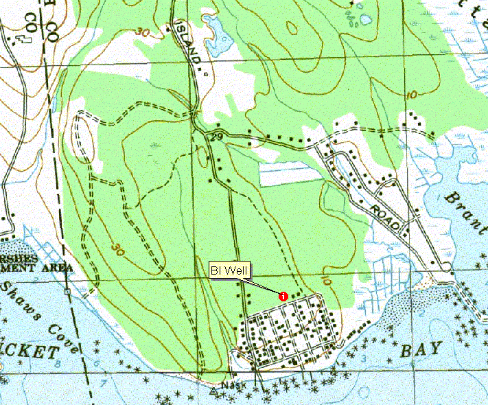
 USGS
Topo Location
USGS
Topo Location| Index well BI (Brant Island, Mattapoisett MA. -Scituate Soil) |
USGS
Topo Location |
LOCATION.--Lat 41.628291 N, Lon -70.831228
W NAD 83. UTM NAD 83, 347,456 Easting, 4,610,129 Northing.
Plymouth County, Town of Mattapoisett - 180 meters east of Brant Beach Road, 50 meters
north of Highland Road, Mattapoisett Conservation Land.
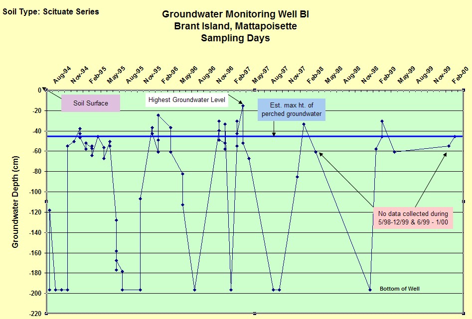
WELL CHARACTERISTICS.--Well type - 2.0 inch diameter screened PVC pipe, total well
depth = 6.45 feet below the surface. Installed August 15, 1994. Data was
recorded between 8/15/94 up to 03/02/00, a total of 64 observations were made.
ELEVATION.-- Surface is 9 Meters (29 feet) above sea level, from topographic map
(National Geodetic Vertical Datum of 1929).
SOIL TYPE.--Scituate Series -
moderately well drained soil formed dense basal till. The estimated average seasonal high water table,
based on soil morphology for this site is 1.5 feet below the surface based on
soil morphology.
GEOLOGY.-- Sandy loam eolian solum underlain by lodgement (dense) till. Landform is a level area of ground moraine.
WELL OBSERVATIONS.--Highest water table depth is 0.5 feet below
the surface on 4/4/97. Below is a hydrograph of the the BI well observations. In general water tables begin to rise in November,
reaching the highest levels during January through June. Water tables drop off
rapidly between mid June to early July. The well is typically dry (> 6.45 feet
below the surface) from mid July through October.
Contact Jim Turenne for more information.