 USGS
Topo Location
Download Monitoring Well locations for viewing with
Google Earth
USGS
Topo Location
Download Monitoring Well locations for viewing with
Google Earth
![]()
| Soil Water Table Monitoring Index well HF -Montauk, Scituate, Mattapoisett Catena |
|
LOCATION.--Lat 41.637234 N, Lon -70.815192
W NAD 83. UTM NAD 83, 348,815 Easting, 4,611,079 Northing.
Plymouth County, Town of Mattapoisett.
WELL CHARACTERISTICS.--This site is a series of shallow and deep
monitoring wells that are located on a drumlin. The wells are on a soil catena
consisting of well drained Montauk soils located on the convex summit,
moderately well drained Scituate soils on the side slope, and poorly drained
Mattapoisett soils on the lowest elevation near a drainageway.
ELEVATION.-- Surface is 12 Meters on HF1 and 9 meters on HF3.
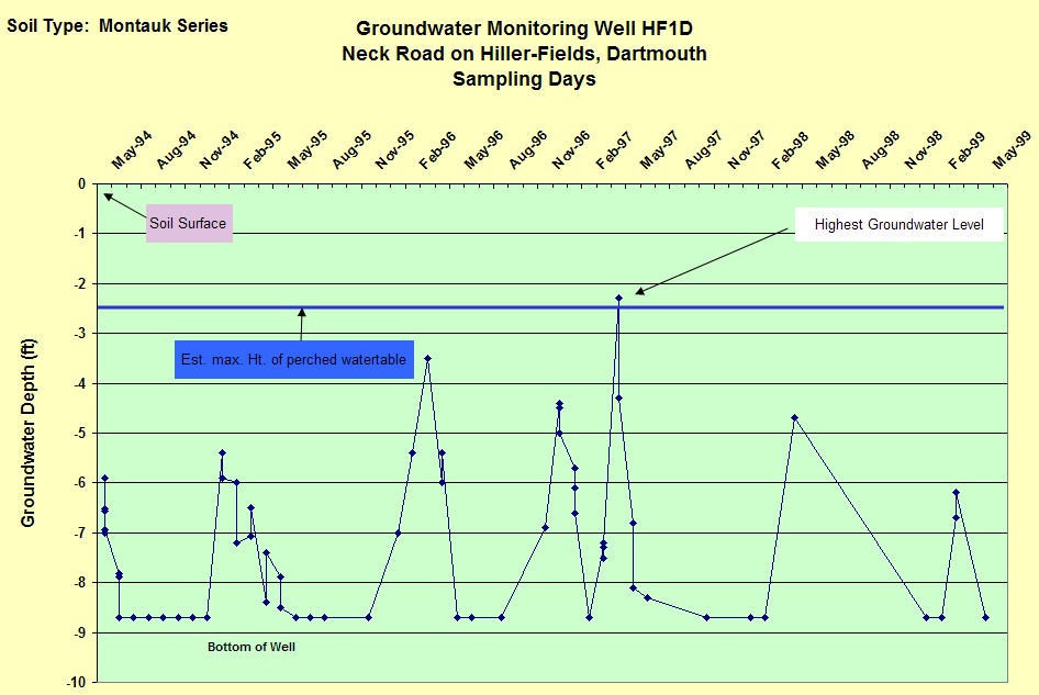
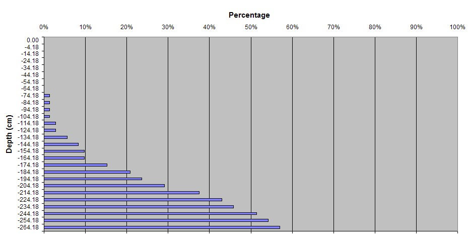
SOIL TYPE.--Montauk (HF1),
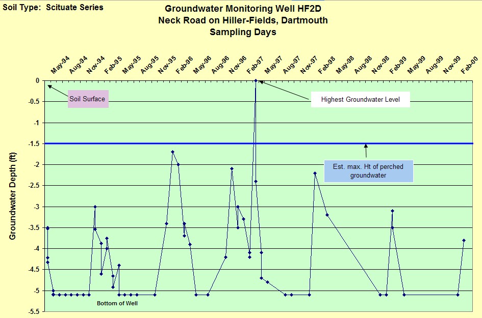
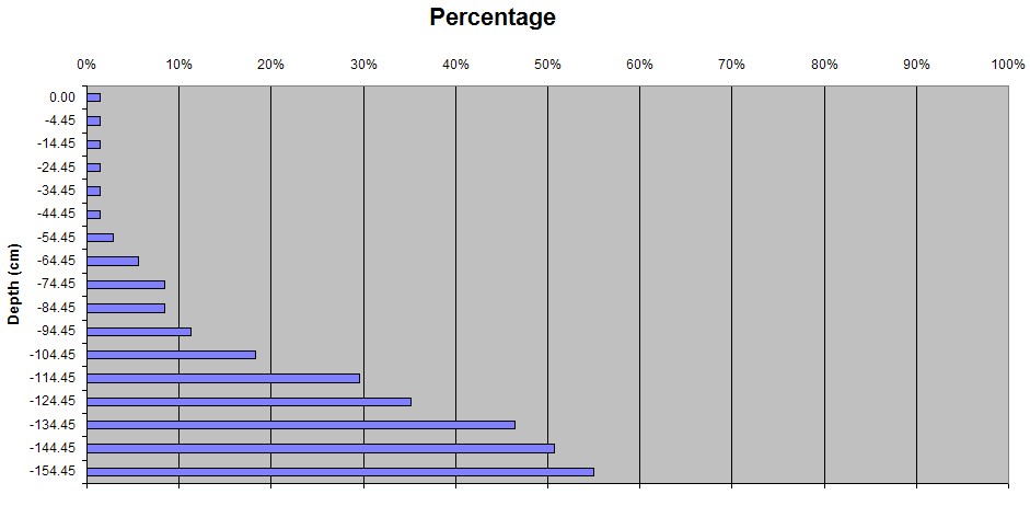
Scituate (HF2), and
Mattapoisett (HF3) series - moderately
well drained soil formed dense basal till.
GEOLOGY.-- Lodgement Till. Landform is a Drumlin, HF1 is on the convex
summit, HF2 is a west facing sideslope, and HF3 in on a concave swale.
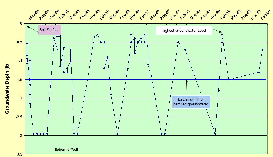
WELL OBSERVATIONS.--Below are the hydrographs of the wells.
HF1: Montauk Soil on Summit of Drumlin:
HF2 - Scituate Soil on side slope of the drumlin
HF3 - Mattapoisett soil (SWPD) near drainageway.
Contact Jim Turenne for more information | Return to Index Wells
Click here to view a presentation about using a
device to measure maximum water table depths (Morgan and Stolt)
USGS Water Resources of
Massachusetts and Rhode Island - Ground-Water Data
WRP Technical Note HY-IA-3.1 Installing Monitoring
Wells/Piezometers in Wetlands