Soil 
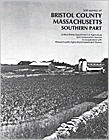
Survey of Bristol County, Massachusetts
Available in Digital Format

Visit the Soil Data Mart to Download Digital Soil Data for Bristol County and Generate Reports

The soils of Bristol County, Massachusetts were surveyed in two parts, North and South. The soil map unit legends in the published surveys are different for each part.


Bristol Soil Survey-South

New

Click here to download
 this survey and view maps

 (41 MB PDF Document
version 6.0)

Bristol County South Includes the Communities of: Acushnet, Dartmouth, Fairhaven, Fall River, Freetown, New Bedford, Somerset, Swansea, and Westport.

Manuscript

Issued: October 1981.
Author: Rino J. Roffinoli and Peter C. Fletcher.
Status: Published report, SSURGO Certified.
Publication scale: Order 2 mapping at 1:20,000 scale with minimum delineations 6-8 acres.
Base Map Imagery: Black and White Orthophotography flown in 1977.

Map Unit Legend (With links to the Map Unit Descriptions)
Click Here for the Soil Maps

Bristol Soil Survey-North Bristol County North Includes the Communities of : Attleboro, Berkley, Dighton, Easton, Mansfield, North Attleboro, Norton, Raynham, Rehoboth, Seekonk, and Taunton.

Manuscript

Issued: November 1978
Author: Rino J. Roffinoli and Charles F. Hotz.
Status: Published report, SSURGO Certified.
Publication scale: Order 2 mapping at 1:20,000 scale with minimum delineations 6-8 acres.
Base Map Imagery: Unrectified Black and White aerial photography flown in 1975.

Click Here: To order a Soil Survey of Bristol County, NORTH

Map Unit Legend (With links to the Map Unit Descriptions)


Back to NEsoil Home Page