Cranberry Bed Soil Profile
Download soil profile locations for viewing with Google Earth
(500 KB KMZ file, requires Google Earth to be installed).
New
England Soil Profiles
Cranberry Bed Soil
Profile
Download soil profile locations for viewing with
Google Earth
(500 KB KMZ file, requires
Google Earth to be installed).
![]() (Link to Site)
(Link to Site)
 |
 |
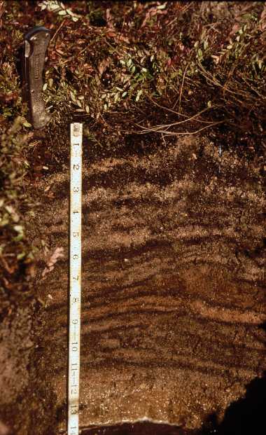
| This profile is from a cranberry bed (Freetown Coarse Sand
map unit). It shows thin (.25 to .5 in) alternating layers of sand and organic
material. The sand is added to the bed surface every 3-5 years for management
purposes (increases aeration, promotes vine grown, etc.). At 11 to 14 inches on
the photo is the first layer of sand added when the bed was constructed or
renovated, below this layer is a buried organic soil (Freetown Series). Photo by Pete Fletcher, photo location - Unknown. |
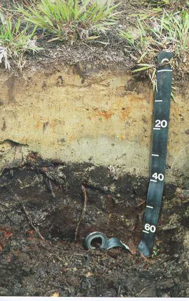
This profile is from a cranberry bed located in Hanson,
Massachusetts. This profile has a 40 cm. layer of fill material overlying
a buried organic soil (Freetown Series). The human-transported fill
material was deposited on the bed sometime between 1977 and 1986 for
cranberry production. The brighter layer (5 to 23 cm.) has prominent redox
concentrations, the gray layer (23 to 40 cm.) is interpreted to be a
gleyed horizon. The buried organic soil (below 40 cm.) consists of highly
decomposed material. Photo by Rob Tunstead, photo location - Burrage Pond Wildlife Management Area, Hanson, MA. Lat: 42.026138 Lon: -070.866736 |
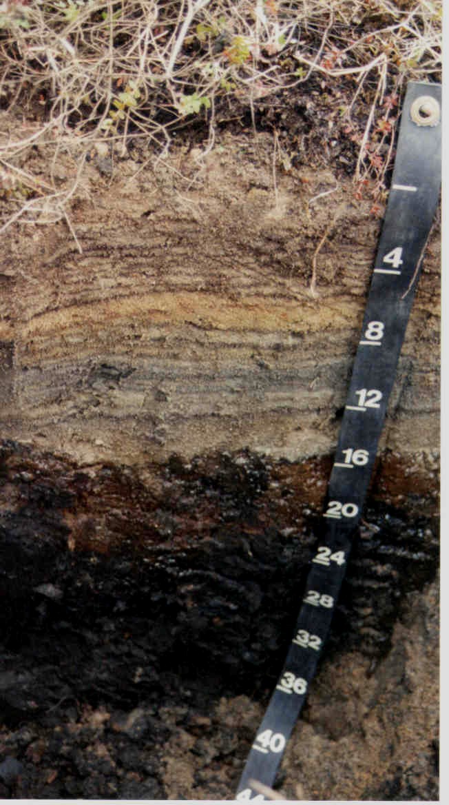
Freetown coarse sand, town of Plymouth Massachusetts: 41 54' 10.6"N, 70
38' 59.4"W
|
More Info on Cranberry Bed Soils
Back to Images 1 | Back to Images 2