 USGS
Topo Location
Download Monitoring Well locations for viewing with
Google Earth
USGS
Topo Location
Download Monitoring Well locations for viewing with
Google Earth
![]()
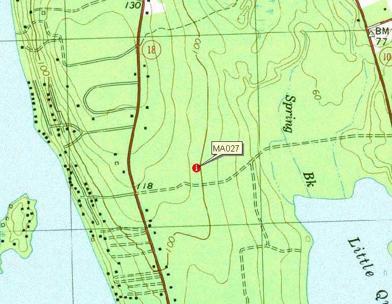
| Soil Water Table Monitoring Index well MA027 - Ridgebury - Scituate Soil Catena, Lakeville, MA. |
|
LOCATION.-- 41°48'5.76" N Lat, 70°55'44.40"W Lon.
Plymouth County, Town of Lakeville, MA. 1,230 feet ENE of the intersection of
Route 18 and Long Pond Shore Drive.
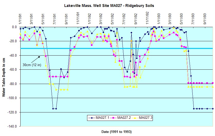
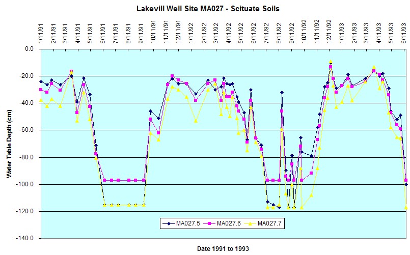
WELL CHARACTERISTICS.--There are 7 wells installed along the side slope
of a drumlin all wells were 2 inch PVC slotted pipe. The wells were labeled
MA027.7 (Scituate soils highest elevation) through MA027.1 (Ridgebury soils on a
concave swale) the wells were installed in January 11, 1991 and monitored
through December, 1993. These wells were installed as part of a hydric soil
study by UMASS (Adopt-A-Well).
ELEVATION.-- Surface is 115 feet above sea level, from Google Earth.
SOIL TYPE.--The network of 7 wells are on a Scituate-Ridgebury Catena.
Wells MA027.5, MA027.6, and MA027.7 are on
Scituate Soils -
moderately well drained soil formed dense lodgement till.
Click for a complete pedon description of the soil log from the
MARS01 well. Wells MA027.4 through MA027.1 (wettest) are in
Ridgebury Soils - poorly drained soils
formed in lodgement till.
GEOLOGY.-- Sandy loam eolian mantle underlain by lodgement till. The
network of wells are on a sideslope of a drumlin from a convex landform to a
concave drainage swale.
WELL OBSERVATIONS.--Below are the hydrographs for the wells - top graph
is for the wells on the concave drainage swale (Ridgebury Soils) the bottom
graph is for the non-hydric Scituate soils.
Contact Jim Turenne for more information | Return to Index Wells
Click here to view a presentation about using a
device to measure maximum water table depths (Morgan and Stolt)
USGS Water Resources of
Massachusetts and Rhode Island - Ground-Water Data
WRP Technical Note HY-IA-3.1 Installing Monitoring
Wells/Piezometers in Wetlands