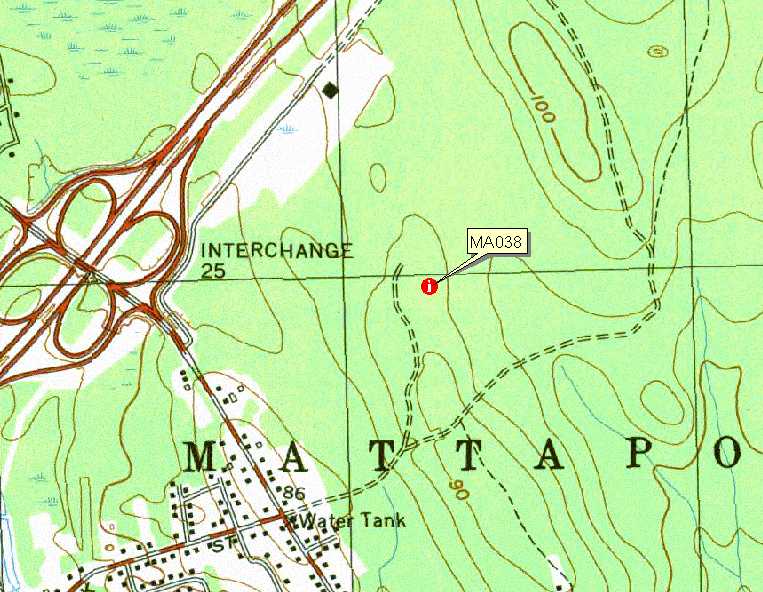
 USGS Topo Location |
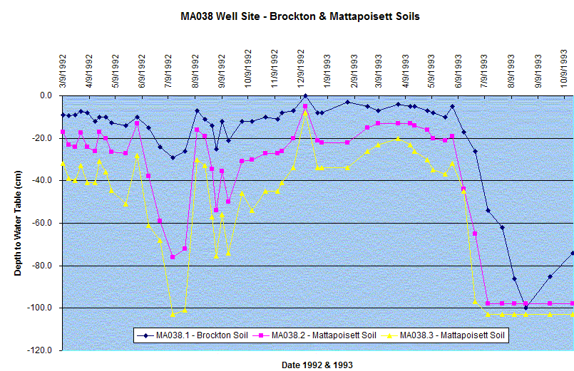
Index well MA038 -Mattapoisett and Brockton Soils
|
USGS Topo Location |
LOCATION.--USGS Marion quadrangle, Town of Mattapoisett - Tinkham
Forest,
Plymouth County, Massachusetts.
http://maps.google.com/maps?f=q&hl=en&geocode=&q=41+40+26,+-70+48+30+&ie=UTF8&ll=41.674691,-70.808322&spn=0.006683,0.014141&t=h&z=16&iwloc=addr&om=0
WELL CHARACTERISTICS.--2 inch slotted PVC pipe, installed and monitored
between 1992 and 2002.
ELEVATION.-- 85 feet (USGS TOPO) .
SOIL TYPES: - Mattapoisett soils for wells MA038.2, MA038.3 - well 38.3
is the type location for the Mattapoisett Series:
http://ortho.ftw.nrcs.usda.gov/osd/dat/M/MATTAPOISETT.html |
Lab data and Pedon Description
Brockton Soils for well MA038.1
Birchwood Soil well data (MA038.5)
GEOLOGY.-- Eolian sand underlain by lodgement till.
WELL OBSERVATIONS.--Below are the hydrographs of the wells.
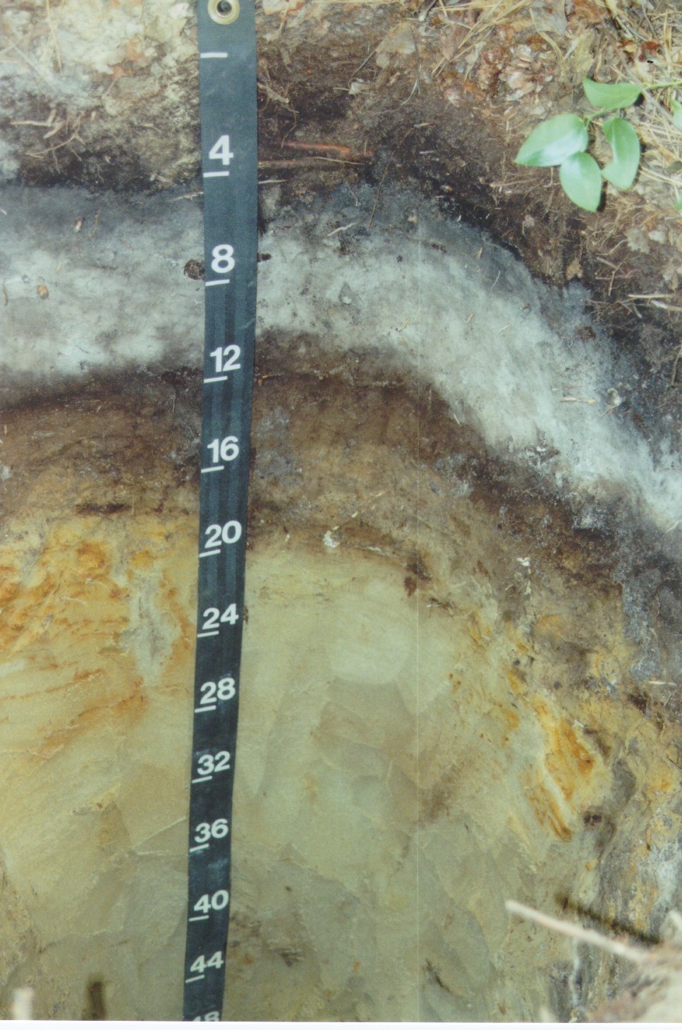
Pedon Description and Lab data for the well above |
Photo for Well above
Contact Jim Turenne for more information.