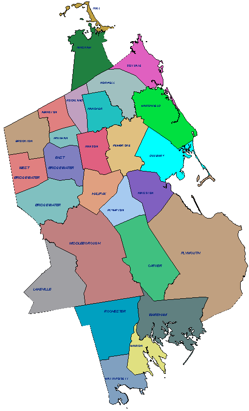
Plymouth County Soil Survey Update
General Soil Map (November 2002)
Click on a town to view the general soil map (all maps are advance copies, subject to change)
General Soil Map Unit Descriptions
| Lakeville | Marion | Mattapoisett | Middleboro | Rochester |
| Wareham | Bridgewater | Carver | Plymouth | Duxbury |
| Kingston | Pembroke new | Plympton new | Hanson | Halifax new |
| Marshfield new | Scituate new | Norwell new | Hanover new |

NOTE: General Soil Maps are NOT the same as the Detailed Soil Maps (1:12,000) which are currently being produced by the Plymouth County Soil Survey. The following explains the intended use of General Soil Maps:
The general soil map shows the soil associations for each town in Plymouth County. Each association (General Soil Map Unit) has a distinctive pattern of soils, relief, and drainage. Typically, an association consists of one or more major soils and some minor soils. It is named for the major soils. The soils making up one association can occur in another but in a different pattern. The general soil map can be used to compare the suitability of large areas for general land uses. Areas of suitable soils can be identified on the map. Likewise, areas where the soils are not suitable can be identified. Because of its small scale, the map is not suitable for planning the management of a farm or for selecting a site for a road, building or other structure. For more specific interpretations use the detailed soil maps available from the NRCS. The soils in any one association differ from place to place in slope, depth, drainage, and other characteristics that affect management. The soils in the survey area vary widely in their potential for major land uses. Each association is rated for agricultural production, woodland and urban uses.