
Soil Survey of Bristol County, Massachusetts
NORTHERN PART
The following Map Unit Description is from the 1981 Soil Survey of Bristol County, NORTHERN Part. Please note: map unit symbols are DIFFERENT for Bristol North and Bristol South reports, do NOT use these descriptions for Bristol South.
Bd-Birdsall silt loam. This soil is deep, nearly level, and very poorly drained. It is in low-lying areas and depressions near large streams. Slopes are plane or slightly concave and are generally 100 to 400 feet long. The mapped areas are elongated or irregular in shape and are 5 to 15 acres in size.
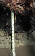
Typically, the surface layer is very friable, very dark gray silt loam about 7 inches thick. The subsoil extends to a depth of 21 inches and is firm, mottled, light brownish gray silt loam and gray very fine sandy loam. The substratum to a depth of 60 inches is friable, grayish brown very fine sandy loam.
Included with this soil in mapping are areas of Raynham soil and Medisaprists, shallow, that are generally less than 3 acres in size. Also included are areas of soils that have a very fine sand substratum and areas of mineral soil that have a layer of surficial peat or muck 4 to 16 inches thick. Included soils make up about 15 to 20 percent of the map unit.
Permeability is moderately slow in the subsoil and slow in the substratum. Available water capacity is high. Reaction ranges from strongly acid to neutral. The root zone extends a few inches below the surface layer. Root growth is restricted by a high water table that is at or near the surface more than 9 months of the year.
This soil has poor potential for farming, urban uses, sanitary waste disposal facilities, and trees. It has fair potential for wetland wildlife habitat. Most acreage is poor quality woodland or is idle.
The soil has severe limitation for hay and pasture because it is wet most of the year. The high water table restricts plant growth and limits use of machinery. Artificial drainage generally is difficult because of the slow permeability.
The soil is poorly suited to trees. Productivity is low. The high water table restricts tree growth, hinders stand reproduction, and limits use of machinery. Important tree species are eastern white pine and red maple.
The soil has limitations for urban use because of the high water table and high potential frost action. The high water table and slow permeability are severe limitations for sanitary waste disposal facilities. Capability subclass VIw.
Birdsall Official Series Description
Back to Bristol County Soil Survey