Soil Survey of Bristol County, Massachusetts
SOUTHERN PART
The following Map Unit Description is from the 1981 Soil Survey of Bristol County, Southern Part. Please note: map unit symbols are DIFFERENT for Bristol South and Bristol North reports, do NOT use these descriptions for Bristol North.
 Scarboro
Profile
Scarboro
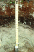
ProfileSc-Scarboro muck.
This soil is nearly level, deep, and very poorly drained. It is in low lying depressional areas that are mostly adjacent to rivers and streams. Areas of this soil are irregular in shape and range from 5 to 125 acres. Most are about 50 acres.
Typically, a 4-inch-thick layer of black muck covers the surface layer. The surface layer consists of black mucky loamy fine sand about 9 inches thick. The subsurface layer is light gray loamy fine sand 8 inches thick. The substratum is gray and extends to a depth of 60 inches or more. The upper 7 inches of the substratum is loamy sand, and the next 4 inches is fine sand. The lower part of the substratum is sand that is partly mottled.
Included with this soil in mapping are areas of Swansea, Pipestone, Walpole, and Wareham soils. Also included are areas where the substratum is firm and areas of silt loam or very fine sandy loam. Included areas make up over 30 percent of many units.
The permeability of this Scarboro soil is rapid or very rapid. Available water capacity is low. Root growth is restricted by a seasonal high water table that is at or near the surface most of the year.
Most areas of this soil are in woodland. A few areas are used for farming.
The seasonal high water table makes this soil poorly suited to farming. The soil is in low lying areas, and the lack of suitable outlets makes it difficult to drain.
The seasonal high water table makes this soil poorly suited to trees. The water table causes a high rate of seedling mortality. It also restricts rooting, making trees susceptible to uprooting during windy periods. Planting water-tolerant species helps to reduce the rate of seedling mortality, and establishing dense stands of trees reduces the hazard of uprooting. The wetness of the soil limits the use of timber harvesting equipment.
The seasonal high water table is the main limitation of the soil for community development, especially as a building site and as a site for septic tank absorption fields and sanitary landfills. The rapid permeability of the soil causes a hazard of ground-water pollution in areas used for septic tanks or landfills.
Capability subclass: Vw.