Index well Ebird -Limerick Soil
USGS
Topo Location
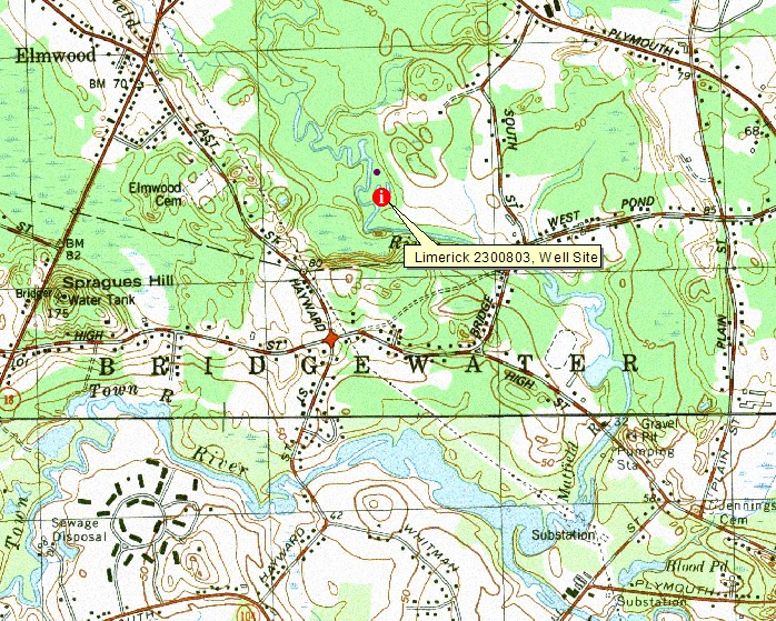
LOCATION.--USGS Whitman quadrangle, Town of East Bridgewater, C.N. Smith Farm, floodplain of the Matfield River. 0.4 miles Northwest of intersection of Bridge St. and South St., 0.7 miles South/Southwest of intersection of Sachem Rock Ave and Route 106. Plymouth County, Massachusetts.
| Latitude: | 42 degrees 0 minutes 31.70 seconds north |
| Longitude: | 70 degrees 56 minutes 57.70 seconds west |
| Datum: | NAD83 |
| UTM Zone: | 19 |
| UTM Easting: | 338578 meters |
| UTM Northing: | 4652592 meters |
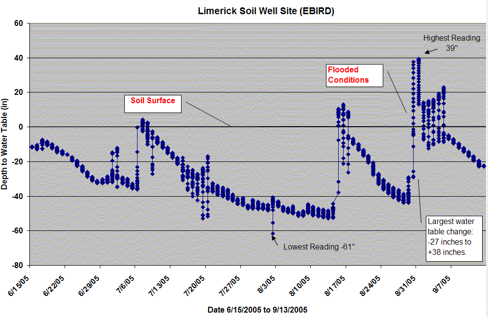
WELL CHARACTERISTICS.--A pressure transducer was installed at this site to a depth of 83 inches, water table depths were recorded at an hourly interval.
ELEVATION.-- 32 feet .
SOIL TYPE.-Mashpee - click here for pedon description | Click for Soil Profile Photo | Click for Map Unit Description
GEOLOGY.-- Silty alluvium.
WELL OBSERVATIONS.--Below is the hydrograph of the well. Readings were recorded each hour, readings above the soil surface show period and duration of flooded conditions. On August 30 2005 the well showed a huge spike from a depth of -29 inches below the surface at 12:00 a.m. to a flooded +38 inches at 11:00 p.m.
Contact Jim Turenne for more information.