Plymouth County Soil Survey
Relationship of Soil, Landscape Position, and Parent Material in the Birchwood-Poquonock-Mattapoisett General Soil Map Unit.
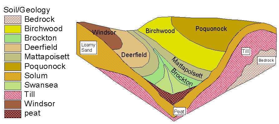
1. Birchwood-Poquonock-Mattapoisett: Very deep, nearly level to moderately steep, well drained to poorly drained soils formed in sandy mantled underlain by loamy firm to friable glacial till in areas of ground moraines and uplands.