Massasoit and Mashpee Series
Download soil profile locations for viewing with Google Earth (500 KB KMZ file, requires Google Earth to be installed).
New
England Soil Profiles
Massasoit and Mashpee
Series
Download soil profile locations for viewing with
Google Earth
(500 KB KMZ file, requires
Google Earth to be installed).
![]() (Link to Site)
(Link to Site)
|
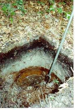
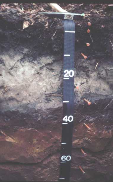
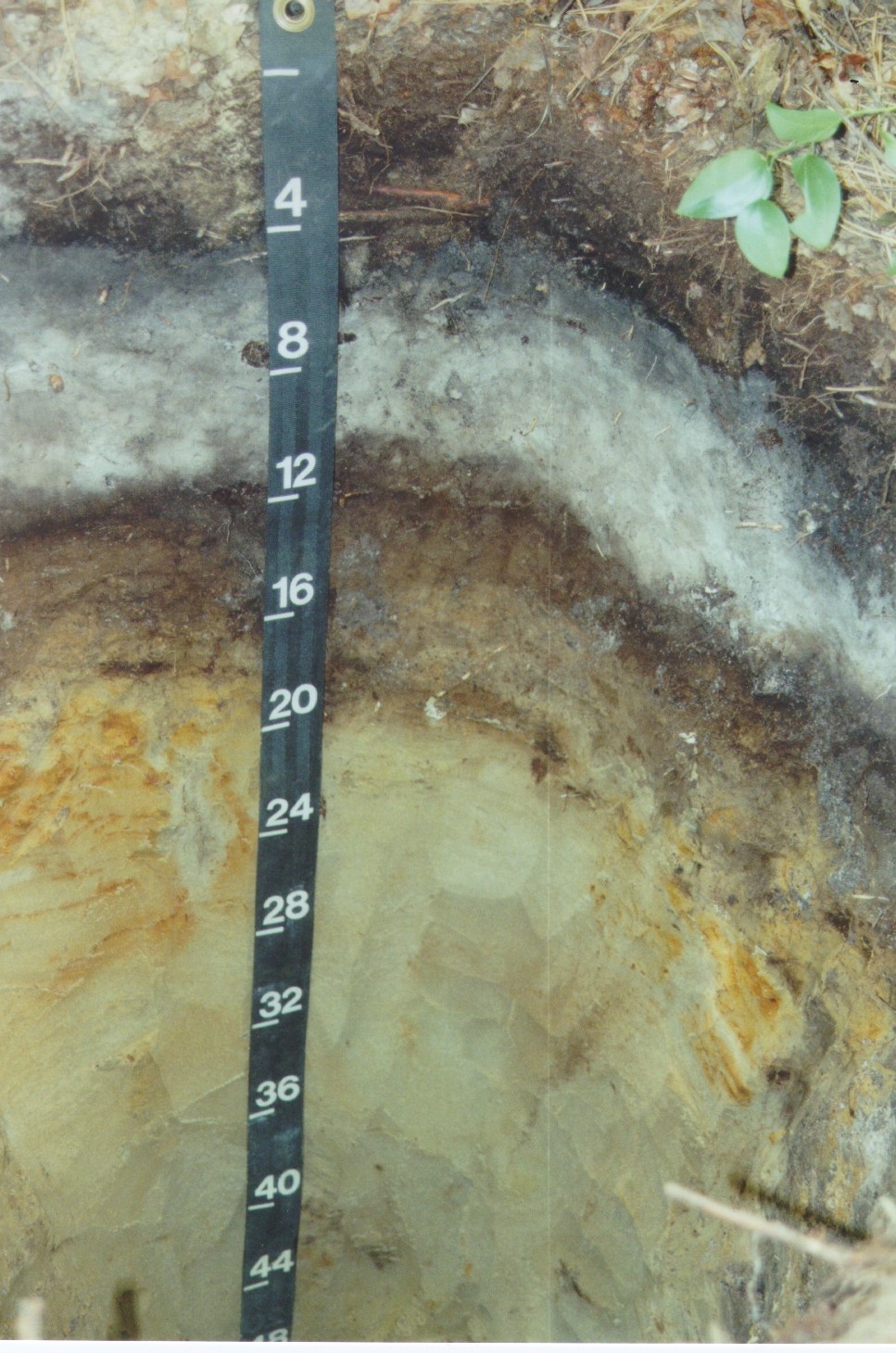
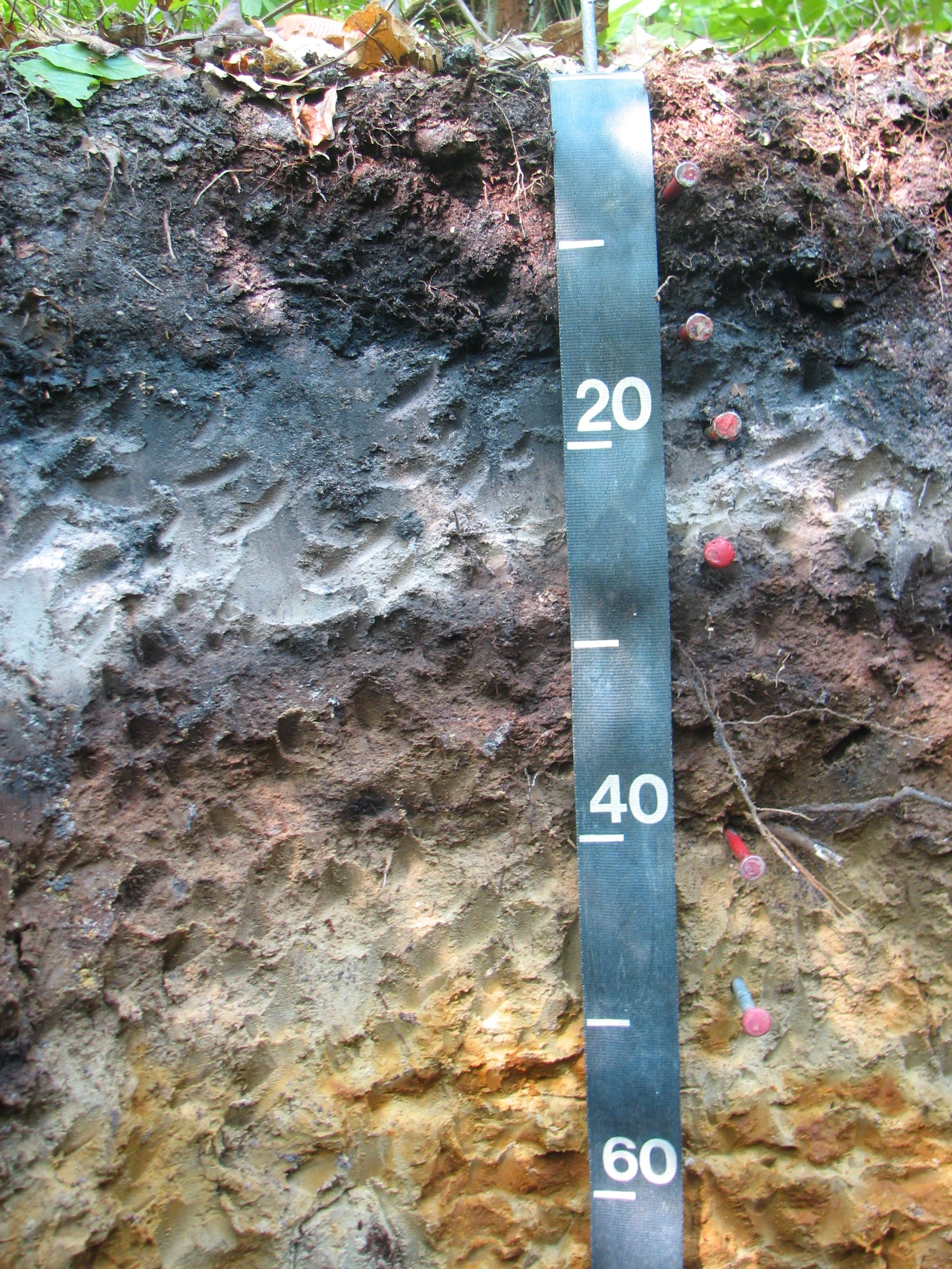
Massasoit soils (formerly mapped Saugatuck Series) and Mashpee soils (formerly mapped Pipestone series) are poorly drained soils formed in glacial fluvial deposits. Massasoit and Mashpee soils are Spodosols and have a leached layer (Eg soil horizon) underlain by iron-humus rich layers, called a spodic horizons (Bh, Bs, Bhs). The photo right has nails placed (right of measuring tape) at each horizon. |
|
 Pedon
S07MA023004 - Mashpee Series (click for full Pedon
S07MA023004 - Mashpee Series (click for fulldescription) |
|
Photos: Pete Fletcher, photo top left - Barnstable
County, Mass. photo right - Wareham, Massachusetts.
Photo Bottom Left: Rob Tunstead
Massasoit Map Unit Description
Back to Images 1 | Back to Homepage