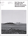
The following is from "Soil Survey of Norfolk and Suffolk Counties,
Massachusetts (Peragallo, 1989)"
Recommended Books: Roadside Geology of Massachusetts (James William Skehan)
Glossary of
Landform and Geologic Terms (NSH)
Related sections: Geology of
Plymouth County | Geology of
Barnstable County
General Geology of Norfolk and Suffolk
Counties, Massachusetts (by Tom Peragallo)
Rudy Chlanda. Geologist. Soil Conservation Service, helped to
write this section.
The maps of both the bedrock geology and the surficial geology of the survey area are at the back of this publication. The maps show a great diversity of bedrock and surficial geology in Norfolk and Suffolk Counties. As in all of New England, the geologic history of the survey area shows repeated advances of thick glacial ice. These advances caused complex deformations of the earth's crust. In addition, glacial erosion and deposition caused the present topography.
The progressing ice scoured the existing bedrock surface, deepening and widening valleys. These were infilled with a veneer of glacial till, glacial outwash, or both, from meltwater streams. In bedrock highlands, different thicknesses of glacial till were deposited. In some places bedrock is exposed and in others deposits of till are as much as 150 feet deep.
The survey area can be divided into two geologic regions, the Boston Basin and the Eastern Plateau. The Boston Basin extends eastward from the Eastern Plateau. Areas l' 2, and 3 on the Bedrock Geology Map at the back of this publication show that underlying the surficial deposits and fill in the Boston Basin are folded and faulted sedimentary and volcanic rocks (27).
The Boston Basin is the result of preferential glacial erosion of softer rocks. It has the characteristics of a glacial outwash plain. Distinct drumlins rise 100 to 200 feet above the plain. The plain drops below sea level as it extends eastward, leaving the drumlins and moraines slightly above sea level to form the Boston Harbor Islands (15, 16). In addition, several famous landmarks in the basin are drumlins, many of which have bedrock cores close to the surface (12). They include Breed's Hill and Bunker Hill in Charlestown and Powder Horn Hill in Chelsea.
Borings and excavations indicate that the ice successively advanced and retreated and that sea level was 50 feet or more below its present level. When the sea level was lower, the Boston Basin was a broad valley where clay had been deposited by water. The basin provided an outlet at the confluence of two major ice lobes or currents, slowing the ice flow (14).
The topography of the Eastern Plateau is characterized by low, rounded hills and open valleys. Glacial erosion of the bedrock surface modified pre- existing valleys. The ice in this area moved, as shown in bedrock striations and drumlin orientations, generally northwest to southeast. Areas l, 2, 3, 4, 5, and 10 on the Bedrock Geology Map at the back of this publication show that the bedrock is dominantly granitic. Areas 8 and 9 on this map show that a small, narrow band of sedimentary and partly metamorphosed sedimentary rocks crosses the survey area from southwest to northeast (27).
The survey area was deglaciated by typical New England stagnation zone retreat. Glacial lakes with their associated deposits formed in front of the stagnant ice. Some of these are Glacial Lakes Medfield and Charles in the present-day Charles River Valley (28, 29). Vegetative successions have since filled in many smaller glacial lakes and ponds, making swamps, bogs, and marshes. Typically, Freetown and Swansea soils are in these locations.
Area Qsg on the Surficial Geology Map at the back of this publication shows that stratified glacial deposits are typically at lower elevations (26). The soils most commonly associated with these deposits are Hinckley, Merrimac, and Windsor soils. Area at on the Surficial Geology Map shows that the hills have a veneer of glacial till. The soils most commonly associated with these deposits are Charlton, Paxton, and Montauk soils.
As the glacier retreated further to the north, glacial lakes drained, and river systems began to develop on the new land surface. Before the surface was vegetated, a layer of windblown material derived from the underlying glacial drift was deposited over parts of the area.
As postglacial drainage developed further, alluvium was deposited along the rivers and streams. Most alluvium consists of organic material, fine sand, and silt but in some areas includes fine gravel. Rippowam and Saco soils formed in these alluvial deposits.
REFERENCES
(12) Flint, Richard Foster. 1971. Glacial and quarternary geology. John Wiley and Sons, Inc., New York. pp. 147-227. illus.
(14) Kaye, Clifford A. 1976. The geology and early history of the Boston area of Massachusetts, a Bicentennial approach. U.S. Geol. Surv. Spec. Rep. 1476, 57 pp., illus.
(15) Kaye, Clifford A. 1978. Surficial geology map of the Boston area, Massachusetts. U.S. Geol. Surv. Bull., open-file rep. 78-111. map.
(16) LaForge, Laurence. 1932. Geology of the Boston area, Massachusetts. U.S. Geol. Surv. Bull. 839, 105 pp.. maps. illus.
(26) United States Geological Survey. 1967. Engineering geology of the Northeast corridor, Washington, DC, to Boston, MA-Coastal Plain and surficial deposits. U.S. Geol. Surv. Misc. Geol. Invest., map 1-514-8.
(27) United States Geological Survey. 1983. Bedrock geologic map of Massachusetts. U.S. Geol. Surv. Misc. Geol. Invest., maps.
(28) Volckmann, Richard P. 1975. Surficial geologic map of the Holliston Quadrangle, Middlesex, Norfolk, and Worcester Counties, Massachusetts. U. S. Geol. Surv. Bull., 1-sheet map.
(29) Volckmann, Richard P. 1975. Surficial geologic map of the Medfield Quadrangle, Norfolk and Middlesex Counties, Massachusetts. U.S. Geol. Surv. Bull., 1-sheet map.