Download a GIS Shape file of the Soil Map Index (with a hyperlink field to the online maps) - zip file
View Official RI Soil Mapping using the Web Soil Survey (or try the DEM Environmental IMS Map)
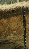
Historic Pedon Descriptions (1959 to 1977)
Soil Survey of Rhode Island
NOTE: All info on RI Soils is now updated at: http://www.ri.nrcs.usda.gov/technical/soils.html
Please visit the NRCS site for Rhode Island Soils Information
Click Here to Download the
Archived Soil Survey of Rhode Island and View the Maps (10 MB PDF
![]() )
)
Download a GIS Shape file of the Soil Map Index
(with a hyperlink field to the online maps) - zip file
View Official RI Soil Mapping
using the Web Soil Survey (or try the
DEM Environmental IMS Map)
Historic
Pedon Descriptions (1959 to 1977)
Historic Documents and Soil Surveys for RI - 1904 to 1943 - new
|
|
Status: Published Soil Survey, SSURGO I
Certified Digital Soil Survey. Published in 1981, majority of field work conducted during the 1970's. Author: Dean D. Rector Field Work by Craig Ditzler, Anthony Dore, Bruce Laskey, Daniel Spangler, Dale Sprankle, Everett Stuart, and Mark Townsend. Includes all Counties and Towns within the State of Rhode Island. |
 |
Download the "Soils of Rhode Island Landscapes" by William R. Wright and Edward H. Sautter. University of Rhode Island Agricultural Experiment Station Bulletin 429, Issued January, 1988. This is a scanned PDF copy of the original bulletin, made available with permission from the URIAES. |
|
|
To Download
"official" RI Soil Survey Data and Reports Visit the Soil Data Mart Download digital soil mapping (for use with GIS) for Rhode Island from RIGIS (instruction coming soon).
Click
here to order a soil survey of Rhode Island |
Visit the RI NRCS Soils Page
| RI Soil
Testing Information RI Soil Laboratory Analysis (terrestrial soils) | Subaqueous Soils |
Historic Archived Documents for RI
|
|
|
|
|
1904 Soil Survey of Rhode Island Soil Map for 1904 survey
- Newport County |
Rhode Island Soil Survey - Map Unit Legend
Click on the Map Unit Symbol for the
map unit description from the published survey.
|
Map Unit |
Map Unit Name |
||||
|
Adrian muck |
Yes | 5w | |||
|
Agawam fine sandy loam, 0 to 3 percent slopes |
Prime | 1 | |||
|
Agawam fine sandy loam, 3 to 8 percent slopes |
Prime | Potentially High | 2e | ||
|
Beaches |
8 | ||||
|
Birchwood sandy loam |
Prime | 2w | |||
|
Bridgehampton silt loam, 0 to 3 percent slopes |
Prime | 1e | |||
|
Bridgehampton silt loam, 3 to 8 percent slopes |
Important | Potentially High | 2e | ||
|
Bridgehampton silt loam, till substratum, 0 to 3 percent slopes |
Prime | 1 | |||
|
Bridgehampton silt loam, till substratum, 3 to 8 percent slopes |
Important | Potentially High | 2e | ||
|
Bridgehampton-Charlton complex, very stony, 0 to 8 percent slopes |
Potentially High | 6s | |||
|
Bridgehampton-Charlton complex, very stony, 8 to 15 percent slopes |
6s | ||||
|
Bridgehampton-Charlton complex, extremely stony, 3 to 15 percent slopes |
Potentially High | 7s | |||
|
Broadbrook silt loam, 0 to 3 percent slopes |
Prime | 1 | |||
|
Broadbrook silt loam, 3 to 8 percent slopes |
Prime | Potentially High | 2e | ||
|
Broadbrook very stony silt loam, 0 to 8 percent slopes |
Potentially High | 6s | |||
|
Canton-Charlton-rock outcrop complex, 3 to 15 percent slopes |
Potentially High | 7s/8 | |||
|
Canton-Charlton-rock outcrop complex, 15 to 35 percent slopes |
High | 7s/8 | |||
|
Canton-urban land complex |
2e/8 | ||||
|
Canton-urban land complex, very rocky |
6s/8 | ||||
|
Canton and Charlton fine sandy loams, 0 to 3 percent slopes |
Prime | 1 | |||
|
Canton and Charlton fine sandy loams, 3 to 8 percent slopes |
Prime | Potentially High | 2e | ||
|
Canton and Charlton fine sandy loams, 8 to 15 percent slopes |
Important | High | 3e | ||
|
Canton and Charlton fine sandy loams, very rocky, 3 to 15 percent slopes |
Potentially High | 6s | |||
|
Canton and Charlton very stony fine sandy loams, 3 to 8 percent slopes |
Potentially High | 6s | |||
|
Canton and Charlton very stony fine sandy loams, 8 to 15 percent slopes |
High | 6s | |||
|
Canton and Charlton very stony fine sandy loams, 15 to 25 percent slopes |
High | 6s | |||
|
Canton and Charlton extremely stony fine sandy loams, 3 to 15 percent slopes |
7s | ||||
|
Carlisle muck |
Yes | 5w | |||
|
Deerfield loamy fine sand |
Important | 3w | |||
|
Dumps |
8 | ||||
|
Enfield silt loam, 0 to 3 percent slopes |
Prime | 1 | |||
|
Enfield silt loam, 3 to 8 percent slopes |
Important | Potentially High | 2e | ||
|
Gloucester-Bridgehampton complex, rolling |
Important | Potentially High | 3e | ||
|
Gloucester-Bridgehampton complex, hilly |
High | 4e | |||
|
Gloucester-Hinckley very stony sandy loams, rolling |
Potentially High | 6s/4s | |||
|
Gloucester-Hinckley very stony sandy loams, hilly |
High | 6s | |||
|
Hinckley gravelly sandy loam, 0 to 3 percent slopes |
Important | 3s | |||
|
Hinckley gravelly sandy loam, rolling |
Important | Potentially High | 4s | ||
|
Hinckley gravelly sandy loam, hilly |
High | 6s | |||
|
Hinckley-Enfield complex, rolling |
Important | Potentially High | 4s/3e | ||
|
Ipswich peat |
Yes | 8 | |||
|
Lippitt gravelly sandy loam, very rocky, 3 to 15 percent slopes |
Potentially High | 4e | |||
|
Mansfield mucky silt loam |
Yes | 5w | |||
|
Mansfield very stony mucky silt loam |
Yes | 7s | |||
|
Matunuck mucky peat |
Yes | 8 | |||
|
Merrimac sandy loam, 0 to 3 percent slopes |
Prime | 2s | |||
|
Merrimac sandy loam, 3 to 8 percent slopes |
Prime | Potentially High | 2s | ||
|
Merrimac-urban land complex |
ws/8 | ||||
|
|
|
||||
|
Narragansett silt loam, 0 to 3 percent slopes |
Prime | 1 | |||
|
Narragansett silt loam, 3 to 8 percent slopes |
Prime | Potentially High | 2e | ||
|
Narragansett very stony silt loam, 0 to 8 percent slopes |
Potentially High | 6s | |||
|
Narragansett very stony silt loam, 8 to 15 percent slopes |
Potentially High | 6s | |||
|
Narragansett extremely stony silt loam, 3 to 15 percent slopes |
Potentially High | 7s | |||
|
Newport silt loam, 0 to 3 percent slopes |
Prime | 1 | |||
|
Newport silt loam, 3 to 8 percent slopes |
Prime | Potentially High | 2e | ||
|
Newport silt loam, 8 to 15 percent slopes |
Important | High | 3e | ||
|
Newport very stony silt loam, 3 to 8 percent slopes |
Potentially High | 6s | |||
|
Newport extremely stony silt loam, 3 to 15 percent slopes |
Potentially High | 7s | |||
|
Newport-urban land complex |
2e/8 | ||||
|
Ninigret fine sandy loam |
Prime | 2w | |||
|
Paxton fine sandy loam, 0 to 3 percent slopes |
Prime | 1 | |||
|
Paxton fine sandy loam, 3 to 8 percent slopes |
Prime | Potentially High | 2e | ||
|
Paxton very stony fine sandy loam, 0 to 8 percent slopes |
Potentially High | 6s | |||
|
Paxton very stony fine sandy loam, 8 to 15 percent slopes |
6s | ||||
|
Paxton extremely stony fine sandy loam, 3 to 15 percent slopes |
Potentially High | 7s | |||
|
Paxton-urban land complex |
1e/8 | ||||
|
Pits, quarries |
8 | ||||
|
Pits, quarries |
8 | ||||
|
Pittstown silt loam, 0 to 3 percent slopes |
Prime | 2w | |||
|
Pittstown silt loam, 3 to 8 percent slopes |
Prime | Potentially High | 2e | ||
|
Pittstown very stony silt loam, 0 to 8 percent slopes |
Potentially High | 6s | |||
|
Podunk fine sandy loam |
Prime | 2w | |||
|
Poquonock loamy fine sand, 0 to 3 percent slopes |
Prime | 2s | |||
|
Poquonock loamy fine sand, 3 to 8 percent slopes |
Prime | Potentially High | 2s | ||
|
Quonset gravelly sandy loam, 0 to 3 percent slopes |
Important | 3s | |||
|
Quonset gravelly sandy loam, rolling |
Important | Potentially High | 4s | ||
|
Rainbow silt loam, 0 to 3 percent slopes |
Prime | 2w | |||
|
Rainbow silt loam, 3 to 8 percent slopes |
Prime | Potentially High | 2e | ||
|
Rainbow very stony silt loam, 0 to 8 percent slopes |
Potentially High | 6s | |||
|
Raypol silt loam |
Yes | Important | 4w | ||
|
Ridgebury fine sandy loam |
Yes | Important | 3w | ||
|
Ridgebury, Whitman, and Leicester extremely stony fine sandy loams |
Yes | 7s | |||
|
Rock outcrop |
8 | ||||
|
Rock outcrop-canton complex |
8/6s | ||||
|
Rumney fine sandy loam |
Yes | Important | 4w | ||
|
Scarboro mucky sandy loam |
Yes | 5w | |||
|
Scio silt loam, 0 to 3 percent slopes |
Prime | 2w | |||
|
Scio very stony silt loam, 0 to 8 percent slopes |
Potentially High | 6s | |||
|
Stissing silt loam |
Yes | Important | 3w | ||
|
Stissing very stony silt loam |
Yes | 7s | |||
|
Sudbury sandy loam |
Prime | 2w | |||
|
Sutton fine sandy loam, 0 to 3 percent slopes |
Prime | 2w | |||
|
Sutton fine sandy loam, 3 to 8 percent slopes |
Prime | Potentially High | 2e | ||
|
Sutton very stony fine sandy loam, 0 to 8 percent slopes |
Potentially High | 6s | |||
|
Sutton extremely stony fine sandy loam, 0 to 8 percent slopes |
Potentially High | 7s | |||
|
Tisbury silt loam |
Prime | 2w | |||
|
|
|
||||
|
Udipsamments |
7s | ||||
|
Udorthents, very steep |
8 | ||||
|
Udorthents-urban land complex |
8 | ||||
|
Urban land |
8 | ||||
|
W |
Water |
||||
|
Walpole sandy loam |
Yes | Important | 4w | ||
|
Wapping silt loam, 0 to 3 percent slopes |
Prime | 2w | |||
|
Wapping silt loam, 3 to 8 percent slopes |
Prime | Potentially High | 2e | ||
|
Wapping very stony silt loam, 0 to 8 percent slopes |
Potentially High | 6s | |||
|
Wapping extremely stony silt loam, 0 to 8 percent slopes |
Potentially High | 7s | |||
|
Windsor loamy sand, 0 to 3 percent slopes |
Important | 3s | |||
|
Windsor loamy sand, 3 to 8 percent slopes |
Important | 3s | |||
|
Woodbridge fine sandy loam, 0 to 3 percent slopes |
Prime | 2w | |||
|
Woodbridge fine sandy loam, 3 to 8 percent slopes |
Prime | Potentially High | 2e | ||
|
Woodbridge very stony fine sandy loam, 0 to 8 percent slopes |
Potentially High | 6s | |||
|
Woodbridge extremely stony fine sandy loam, 0 to 8 percent slopes |
Potentially High | 7s |