Laboratory Data of Soils in Southern New England
Download a point location with links using Google Earth![]() (Requires Google Earth)
(Requires Google Earth)
|
While a soil survey is in progress data is collected
about the
chemical and physical properties of the soils in the survey area.
The data is used to correlate and classify the soils and provide
interpretive information. Laboratory analysis
is conducted by the USDA's
National
Soil Survey Lab located in Lincoln, Nebraska. Additional laboratory analysis
is also conducted by the University's that are part of the NCSS. Below is a list
of soil series which were sampled by the NSSL and links to the
lab data sheet. Other information such as the description of the
soil is available by clicking on the map unit descriptions of each series.
For information and explanations about using the lab data sheets
please send an email to
jimturenne@gmail.com or visit:
http://ncsslabdatamart.sc.egov.usda.gov/ Map showing all lab data and links for the world
|
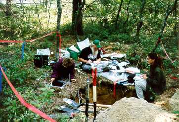 Soil Scientists Collecting Soil Samples for Laboratory Analysis |
Jump: Rhode Island Lab Data | Connecticut Lab Data
All Pedons Sampled in Plymouth County,
Massachusetts(372KB)
All Pedons Sampled in Bristol County, Massachusetts
All Pedons Sampled in Suffolk County, Massachusetts
All Pedons Sampled in Essex County, Massachusetts
By Soil Series
Agawam S54-MA-023-006
Berryland S07MA023003 (with
Pedon Description)
Birchwood (S-93-MA-023-003),
Pedon Description,
Photo of Pedon
Birchwood (S-94-MA-023-003)
Soil Interpretation Record (Soil5), Map Unit Description
Birdsall (S07MA023002 with
Pedon Description
Brockton (S-93-MA-023-002),
Soil Interpretation Record (Soil5),
Map Unit Description
Carver (S-91-MA-023-002),
Pedon Description, Map Unit Description
Carver (S57-MA-023-002) |
Carver (S57-MA-023-005) |
Carver (S59-MA-023-001) |
Carver (S59-MA-023-002)
Deerfield (S-91-MA-023-005),
Pedon Description, Soil Interpretation Record (Soil5),
Map Unit Description
Eldridge (S-94-MA-023-004),
Pedon Description |
Map Unit Description
Essex S57-MA-023-001(Essex soils are now
mapped Montauk soils in Plymouth County)
Hinesburg (S-94-MA-023-005),
Pedon Description |
Map Unit Description
Massasoit (S91-MA-023-004 -
formerly Saugatuck), Pedon
Description |
Map Unit Description
Mattapoisett (S-93-MA-023-001),
Pedon Description |
Map Unit Description
Mattapoisett (S-91-MA-023-003),
Pedon Description, Map Unit Description
| Water Table Data
Mashpee (S07MA023004) - With
links to pedon and water table data
Poquonock (S-94-MA-023-001) |
Pedon Description |
Map Unit Description
Poquonock (S-94-MA-023-002) |
Pedon Description
Ridgebury (S-91-MA-023-008),
Pedon Description |
Map Unit Description
Ridgebury (S-57-MA-023-004)
Scio (S-91-MA-023-009),
Pedon Description | Map Unit Description
Tihonet (S07MA023001) with Pedon
Description
Wapanucket (S-91-MA-023-010) |
Pedon Description |
Map Unit Description
Windsor (S-91-MA-023-006),
Pedon Description, Map Unit Description
Windsor (S-54-MA-023-005)
Woodbridge (S-91-MA-023-007),
Pedon Description,
Map Unit Description
Sudbury - S01-RI-009-002 - Block
Island, RI.
Woodbridge - S01-RI-009-001 -
Block Island, RI
Bridgehampton - S00-RI-009-002
Charlestown, RI
Enfield - S00-RI-009-001 -
Kingston, RI
Newport - S58-RI-009-001 -
Narragansett, RI
Newport - S58-RI-005-001 -
Middletown, RI
Subaqueous Soils in Ninigret Pond (Not yet linked in Google Earth KML file)