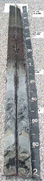
Billington - Coarse-silty, mixed, nonacid, mesic,
Thapto-Histic Sulfiwassents
Soil Laboratory Analysis
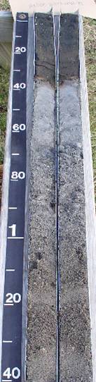
Nagunt - Mixed, mesic, Sulfic Psammowassents |
General Information:
Glossary Of Terms For
Subaqueous Soils, Associated Landscapes, Landforms, And Related
Materials- by Mark Stolt
Resources/Publications:
NEW Thesis papers on Coastal Blue Carbon in
Tidal Marsh Soils for Southern New England and Mid-Atlantic States
(spoiler alert - use soils data for carbon estimates):
Manetta - 2026 - A Pedogeomorphic Strategy for Tidal Marsh Carbon
Accounting
Duball-2019 Impacts of Oyster Aquaculture on Subaqueous Soils and
Infauna
Payne - 2007 -
LANDSCAPE-LEVEL ASSESSMENT OF SUBAQUEOUS SOILS AND WATER QUALITY IN
SHALLOW EMBAYMENTS IN SOUTHERN NEW ENGLAND (Thesis)
Distribution and variability of Coastal Blue Carbon in Tidal Marsh Soils
of Southern New England (Joe Manetta)
Distribution and variability of Carbon Stocks in Mid-Atlantic Tidal
Marsh Soils (Jordan)
Stolt, Manetta - Pedogeomorphic strategy blue carbon accounting in tidal
marsh soils
Stolt,
Manetta - Modeling particle size distribution in subaqueous soil survey
applications
Mapping Shallow Coastal Ecosystems: A Case Study of a Rhode Island
Lagoon (JCR paper), Stolt, Bradley, Turenne, Payne
Estuarine Subaqueous Soil Temperature (Stolt, Salisbury 2011)
Payne, Stolt - Understanding sulfide distribution in subaqueous soil
systems in southern New England, USA
Freshwater
Subaqueous Soil Survey - Baaken/Stolt - Thesis Defense
Freshwater Subaqueous
Soil Survey - Condensed, RI Work Plan Conference
MapCoast 41N Special Edition
Demas, Rabenhorst, 2001 Factors of Subaqueous soil formation
Demas, Rabenhorst, 1998 World Congress Proceedings resource
Demas, Rabenhorst, 1999 Pedogenesis in submerged environment
Demas - Soil Survey
Horizons, Submerged Soils: A New Frontier in Soil Survey
Bradley, Stolt, 2002 Subaqueous Soil Relations in a RI Estuary
Bradley, Stolt, 2003 Subaqueous Soil-Landscape Relationships
Bradely, Stolt, 2006 Landscape-level sea grass, sediment relation
Demas etal 1996 Subaqueous soils pedological approach
Osher,
Flannagan 2007 Soil landscape relationship
Stolt and Rabenhorst SAS workshop 2010 draft
Erich_etal_2010 Subaqueous soils: their
genesis and importance in ecosystem management
Jespersen, Osher
2007 Carbon storage
Payne - Soil Survey Horizons, Fall
2009 - MapCoast Partnership
Surabian - Soil Survey Horizons
Winter 2007 Moorings
Kubiena, Soils of Europe - Section on
Subaqueous Soils
Draft Methods Manual for Subaqueous Soil
Mapping
MapCoast 2004 User
Conference Synthesis Report
Ditzler - Classification, Mapping, and Interpretation of Subaqueous
Soils (Draft)
Demas -
Subaqueous Soils of Sinepuxent Bay Maryland: Ph.D. Dissertation
Salisbury, Stolt - Developing Subaqueous Soil Interpretations
Web/Internet Resources
Coastal Zone Soil Survey Information
Page - NRCS
Google Map showing soil cores collected in Barnegat Bay NJ
Point Data Google Earth File showing location of subqueous soil
observations in RI.
Presentations:
Presentations from the 2018 Coastal Zone Workshop,
Savannah Georgia
Presentations from the
2nd National Workshop on Subaqueous Soils 2010 Rhode Island
Presentations made
at the National Workshop for Subaqueous Soils in Delaware 2003
Benthic Geologic Habitat Mapping (Oakley)
Subaqueous Soil Landscapes Help To Understand Patterns in Coastal
Acidification (Still)
Coastal Blue Carbon - Presentation on
soil organic carbon in subaqueous soils (Stolt)
Multimedia (YouTube
Channel)
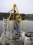
Vibracoring 101 -
how to video on collecting subaqueous soil cores
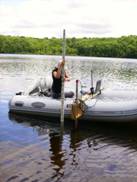
Subaqueous Soil
Mapping - Great Salt Pond
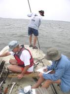
Sampling a Tidal
Marsh Soil - Narrow River, RI
Video
on Acid Sulfate Soils - 8th International Conference
Ecologic Site
Inventory - Subaqueous soils
Sea
Level Rise and submerged soils
Violent Soil
- Reaction with peroxide and sulfides.
Nesoil video page
MapCoast Watershed
Report - 2005 Stolt/Bradley |
Youtube
MapCoast Watershed Reort - 2007 Turenne |
YouTube
Freshwater
Subaqueous Soil Sampling - Penn State
Soil Scientist
discussing the Pishaqua Soil Series
Email
me for more information |

Point Judith Pond, RI
SAS Data Products:
bathy, acoustic, soil, habitat
Vibracoring
Soil Mapping/Data Collection
Freshwater Bathymetry
George Demas
http://en.wikipedia.org/wiki/
Georege_Demas
Eelgrass meadow growing on Nagunt Soils |